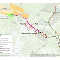
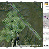
The 6,474 hectare Tad/Toro Project, NTS map sheets 115I/5 & 12 and 115J/8 & 9, is located on Hayes Creek, within the Dawson Range of central Yukon, 100 km northwest of Carmacks, which is 177 km by road from Whitehorse, Yukon. The property is situated in the Whitehorse Mining District with a latitude and longitude of 62o33’N, 137o57’W. The claims are registered to Triumph Gold Corp. Ltd.
The Tad/Toro Project is situated within the 100 km long Big Creek portion of the 250 km long Dawson Range Copper-Gold Belt, which hosts several deposits and mineralized showings of several deposit models including calc-alkalic porphyry copper-gold-molybdenum, intrusion related gold, associated adjacent epithermal vein and breccia systems and peripheral polymetallic veins.
Deposits within the belt are hosted by similar rocks to the Tad/Toro Project and include the Casino porphyry copper-gold-molybdenum deposit (55 km northwest of the Tad/Toro Project), the Laforma low sulphidation epithermal vein deposit and the Antoniuk intrusion related gold deposit (60 km southeast of the Tad/Toro Project). Strong similarities exist with the Nucleus deposit on Triumph Gold’s Freegold Mountain Project (40 km southeast of the Tad/Toro Project).
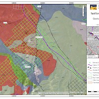
The Tad/Toro Project is primarily underlain by quartz-hornblende-biotite granitic rocks of the Mid Cretaceous Dawson Range Batholith, including the Coffee Creek granite phase, that intrude meta-igneous and meta-sedimentary rocks of the Yukon-Tanana Terrane. The above units are intruded by quartz feldspar porphyry stocks and dykes of the Late Cretaceous Prospector Mountain Suite, which are known to be associated with gold and copper mineralization within this belt, and are overlain by basalt flows of the Upper Cretaceous Carmacks Group.
Mineralization consists of disseminated pyrite within the Tad porphyritic intrusion and narrow sphalerite, galena, and arsenopyrite bearing quartz veins in breccia zones and northerly trending fault zones. The pyrite mineralization may represent a halo to a porphyry copper-molybdenum-gold system. Molybdenite occurs within altered potassium feldspar megacrystic quartz monzonite in the Moly Zone in the eastern property area.
Historic drill core from the Main Zone exhibits extreme oxidation with many unsampled oxidized and brecciated sections. A supergene enrichment zone occurs near the top of many of the drill holes in the centre of the mineralized zone. The sulphide minerals are oxidized to a depth of 80m and the gold-bearing oxide zone lies in brecciated and intensely altered quartz monzonite porphyry, below which is a hypogene zone containing up to 10% disseminated pyrite in porphyritic granite.
Historical drill results from the Main Zone include 1.05 g/t Au and 19.5 g/t Ag across 7.15m including 4.11 g/t Au and 50.1 g/t Ag across 1.06m from DDH T69-2, 1.37 g/t Au and 30.2 g/t Ag across 0.91m from DDH T70-9 and 0.69 g/t Au and 116.6 g/t Ag across 0.3m from DDH T70-12, despite extremely limited sampling of the core. Sampling in 2007 of an unsplit drill interval from DDH T70-12 in 2007 returned significant results of 1.13 g/t Au and 8.7 g/t Ag over 7.9m, including 5.07 g/t Au and 29.5 g/t Ag over 0.9m indicating that the remaining unsplit core from the 1969-70 drill program should be split and sampled.
The Nit occurrence, also on the Tad/Toro property, comprises three large gold soil geochemical anomalies that have not been adequately tested by trenching or drilling. Limited trenching in 1986 indicated a host rock of intensely clay-altered Coffee Creek granite with heavily oxidized quartz veining and faulting. Values in the old trenches that require further investigation include 0.46 g/t Au and 26.1 g/t Ag over 37.8m, and 0.55 g/t Au and 106.6 g/t Ag over 30.0m.


